Resources
Hermit’s Peak Calf Canyon Fire Resources
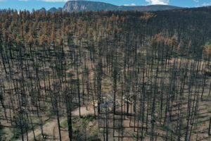
The largest wildfire in New Mexico’s recorded history will have lasting impacts on our community and our watershed. NMFWRI has helped to create web based
The largest wildfire in New Mexico’s recorded history will have lasting impacts on our community and our watershed. NMFWRI has helped to create web based
NMFWRI’s GIS Team has developed the New Mexico Fire Viewer, an interactive web map that provides access to real-time and historical wildfire data. The web
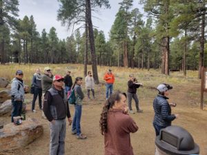
Our Institute, along with our two sister Institute’s, make up the Southwest Ecological Restoration Institute’s (SWERI). We recently held our annual meeting in Flagstaff, Arizona
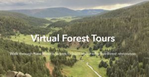
Virtually walk through New Mexico forests to learn about effective forest restoration. What should a forest look like after a restoration project? In an age
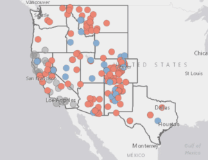
The goal of the Collaborative Mapping Project is to create a one stop searchable map and database of all the collaborative groups and collaborative support
The NMFWRI Unmanned Aerial Systems (UAS) Team was formed in 2018 to help bring high-end, mapping-grade UAS technology to the region. We work to with