• Skip to primary navigation
  • Skip to main content
  • Skip to footer
NMFWRI Logo

New Mexico Forest and Watershed Restoration Institute

  • About
    • Staff Directory
    • Annual Reports
    • Newsletters
    • Join Our Team
  • Restoration
    • Collaborative Forest Restoration Program (CFRP)
      • CFRP Long Term Monitoring
    • Forest Visualization
    • Desired Conditions Past Workshops
      • Gila Mountains – Desired Conditions Workshop
      • Sacramento Mountains Desired Conditions Workshops
    • Tamarisk Leaf Beetle
  • Collaboration
    • New Mexico Collaborations
      • Grant County Eco-Watershed Working Group
      • Connecting for Conservation in Santa Fe
      • Magdalena Collaborative
        • Magdalena Collaborative Web Map
      • Mountainair Collaborative
        • Mountainair Collaborative Web Map
      • North Sacramento Mountains Working Group
        • Watershed Planning Map
      • Otero Working Group
        • Watershed Planning Map
      • Smokey Bear Collaborative
    • Estancia Basin Monitoring
      • South Mountain Weather Station
    • The Collaborative Conservation Mapping Project
    • Greater Rio Grande Watershed Alliance
      • NMFWRI Monitoring Work and Reports for GRGWA by SWCD
      • GRGWA Projects Online Web Map
      • Other Documents and Resources
  • Mapping
    • NM Vegetation Treatment Mapping
    • NM Fire Viewer
    • Field Monitoring Projects Web Map
    • GRGWA Projects Online Web Map
    • Hard Copy Maps / Posters
  • Monitoring
    • Ecological Monitoring
    • UAS/Drone Monitoring
    • Research
    • Summer Student Internships
  • Resources
    • New Mexico Plant Guides
    • Hermit’s Peak Calf Canyon Fire Resources
    • Restoration Resources
    • GIS Tutorials

Contact Us

  • LinkedIn
  • Facebook

Mapping

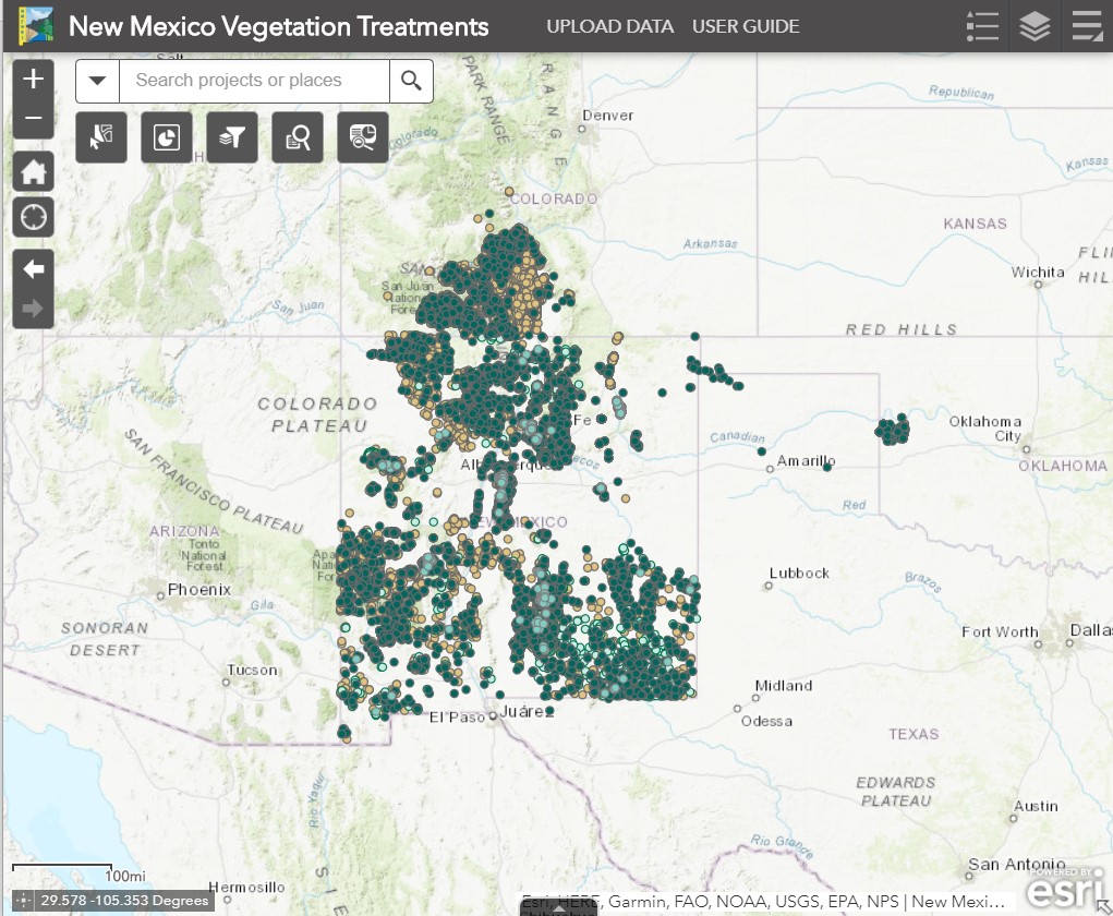
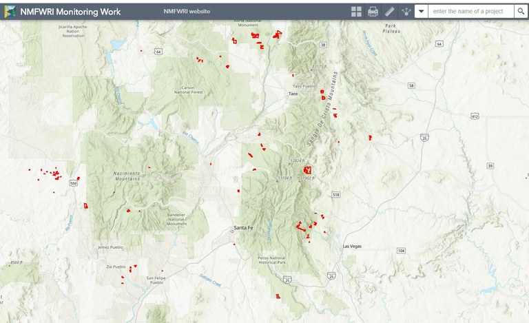
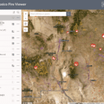
NMFWRI represents the state’s only dedicated capability for supporting the spatial data analysis needs of external stakeholders in the natural resources sector, as well as the GIS/GPS capacity for Highlands University and for most of northern New Mexico. NMFWRI’s GIS work also provides help with maps and other geographic information to New Mexico groups engaged in forest restoration and land management, but who are too small to maintain their own GIS capability. These groups include soil and water conservation districts, municipalities, private groups and individuals, and tribal organizations.

NM Vegetation Treatment Mapping

NM Vegetation Treatment Mapping

Field Monitoring Projects Web Map

Field Monitoring Projects Web Map

UAS/Drone Monitoring

UAS/Drone Monitoring

GIS Tutorials

GIS Tutorials

Aspen Trees

Hard Copy Maps / Posters

Opportunity Map Webinar

Mapping for Collaboration Webinar Series

Mapping for Collaboration Webinar Series

The Collaborative Conservation Mapping Project

The Collaborative Conservation Mapping Project

Footer

Contact

New Mexico Highlands University
Box 9000
Las Vegas, NM 87701

(505) 426-2080
stacimatlock@nmhu.edu

Connect

Facebook
LinkedIn

Partners

Highlands University
Colorado Forest Restoration Institute
Ecological Restoration Institute
After Wildfire
All About Watersheds
New Mexico State Forestry
USFS Region 3

The New Mexico Forest and Watershed Restoration Institute at New Mexico Highlands University receives financial support through the Cooperative and International Programs of the U.S. Forest Service, Department of Agriculture, under the Southwest Forest Health and Wildfire Prevention Act. In accordance with Federal law and U.S. Department of Agriculture policy, this institution is prohibited from discriminating on the basis of race, color, national origin, sex, age, or disability. (Not all prohibited bases apply to all programs.) To file a complaint of discrimination, write to USDA, Director, Office of Civil Rights, 1400 Independence Avenue, SW, Washington, DC 20250-9410 or call (800) 795-3271 (voice) or (202) 720-6382 (TTY). NMHU is an equal opportunity provider and employer.