
News
HPCC wildfire map honored at international GIS conference
The story of the devastating 2022 Hermit’s Peak/Calf Canyon wildfire and its aftermath gained renewed interest and an award during the recent Esri User Conference
The story of the devastating 2022 Hermit’s Peak/Calf Canyon wildfire and its aftermath gained renewed interest and an award during the recent Esri User Conference
More than a dozen landowners from Mora and San Miguel Counties gathered in Mineral Hill for the Plants as Post-fire Restoration Tools workshop hosted by
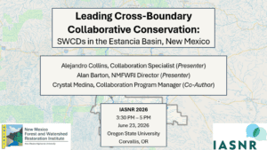
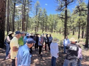
By Alejandro Collins, Collaboration Specialist In June, Collaboration Specialist Alejandro Collins attended the 40th annual conference of the International Association for Society and Natural
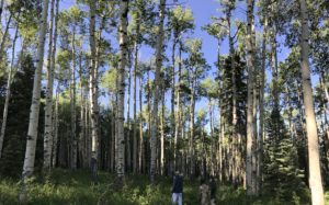
As the school year sunset, the Conservation Science Center’s summer programming for 17 high school aged students kicked off with the four-day Summer Field Experience,
Alan Barton, NMFWRI Director 2026 marks a milestone in the history of the United States, as we celebrate 250 years as an independent nation.
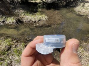
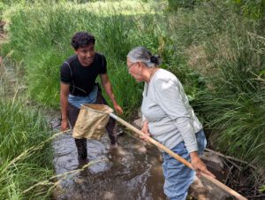
Along New Mexico streams and rivers, professionals use a variety of low-tech structures to reduce erosion, restore stream banks, and help spread streamflow across the
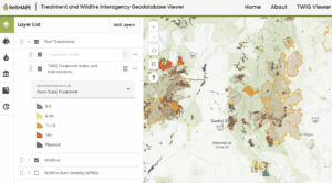
The Treatment and Wildfire Interagency Geodatabase (TWIG), a mapping application developed by the Southwest Ecological Restoration Institute’s ReSHAPE Program, has received the Interactive Ingenuity award
This summer, the Ecological Monitoring Program is excited to welcome several new team members based in Las Vegas. Joan Kuyo, Matthew Najera, and Mitchell Dennington
In late May, the NMFWRI Collaboration Program attended Confluence 2026, hosted by the Western Collaborative Conservation Network (WCCN) and co-convened by Crowd Conservation, Trees, Water &