The story of the devastating 2022 Hermit’s Peak/Calf Canyon wildfire and its aftermath gained renewed interest and an award during the recent Esri User Conference in San Diego, Calif.
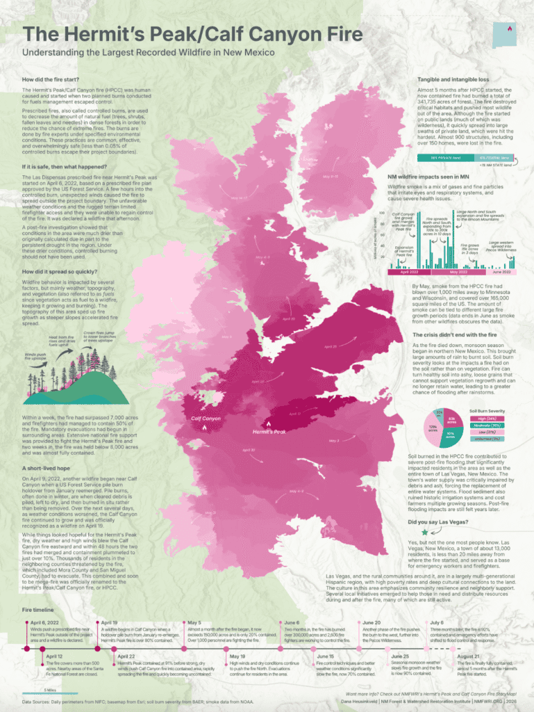
Dana Heusinkveld, a GIS research specialist with the New Mexico Forest and Watershed Restoration Institute (NMFWRI) based at Highlands University, designed a beautiful poster with a map and text describing the events leading up to the wildfire that burned more than 340,000 acres in northern New Mexico, burned hundreds of houses and other buildings, and was followed by damaging post-fire floods. Her map was awarded first place in Place Perception, one of a dozen categories at the July 13-17 conference that attracted more than 600 entries from around the globe.
In their comments, Esri judges praised the map’s “powerful sense of progression through its skillful use of color and composition. The growth of the fire unfolds naturally across the page while the chart colors are beautifully coordinated with the map, reinforcing the story and creating a unified design.”
The Esri Users Conference brings together GIS practitioners from across the country and globe to share ideas, techniques, and inspiration for geospatial applications and storytelling.
See Heusinkveld’s map and other maps in various categories at https://www.esri.com/en-us/about/events/uc/agenda/map-gallery-awards#place-perspective-award
NMFWRI’s GIS team also presented to more than 100 GIS colleagues at the conference regarding the HPCC Post-fire Resource Hub. The team, which includes program manager Patti Dappen, Katie Withnall, and Heusinkveld, also presented on a ReSHAPE, a program and online tool to collect and analyze data on fuel treatment projects and wildfires at the national level. ReSHAPE is a joint effort under the Southwest Ecological Restoration Institutes, of which NMFWRI is a member. Find out more at https://reshapewildfire.org/home