The Treatment and Wildfire Interagency Geodatabase (TWIG), a mapping application developed by the Southwest Ecological Restoration Institute’s ReSHAPE Program, has received the Interactive Ingenuity award at the 2026 Esri Federal GIS Conference Virtual Map Gallery—a recognition of innovation in interactive geospatial tools.
The Interactive Ingenuity award, presented as part of Esri’s annual Federal GIS Conference, recognizes geospatial applications that demonstrate exceptional creativity and technical innovation in interactive mapping. TWIG’s selection reflects both the sophistication of the tool and the importance of its mission: making complex, multi-agency data accessible and actionable for the entire wildfire management community.
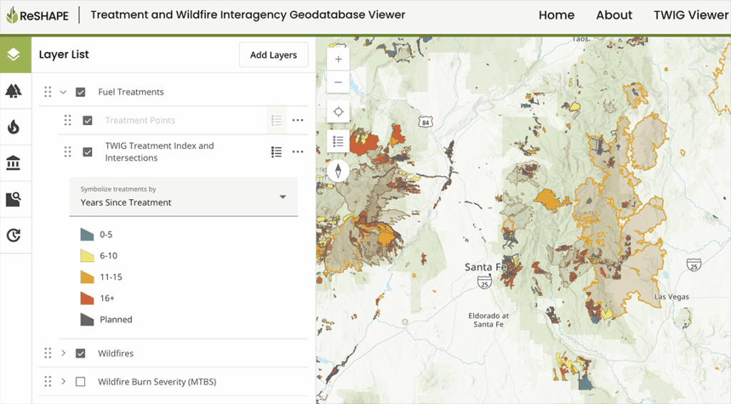
TWIG is an open-access, open-source platform that compiles and displays data on fuel treatments and wildfires nationwide. Developed through partnerships with the USDA Forest Service, the Department of the Interior, and the National Association of State Foresters, the tool gives land managers, researchers, policymakers, and communities a shared system for accessing and applying cross-boundary fuel treatment data. Users can explore the data interactively in the TWIG viewer or download it for use in other analysis programs.
As wildfires continue to grow in size and severity, coordinated fuel treatment planning across boundaries has never been more critical. Historically, siloed data systems made it difficult for the wildfire management community to evaluate the extent and effectiveness of treatment efforts at a landscape scale. TWIG addresses this gap by bringing together treatment records and wildfire perimeters from multiple federal and state systems into a single, accessible platform, reshaping how fuel treatment data are visualized, accessed, and applied.
“SWERI’s work shows what’s possible when we make wildfire data accessible and actionable. It gives the public and decision-makers a clearer picture of treatments, outcomes, and provides additional context to ultimately help people make better decisions on the ground,” said Anthony Schultz, Director of Wildland Fire Solutions at Esri.
This recognition is a testament to the power of interagency collaboration and the value of open data in addressing complex environmental challenges. The ReSHAPE Program extends its gratitude to its federal agency partners and to Innovate Inc., whose technical contributions have been instrumental in bringing TWIG to where it is today.
To explore TWIG, visit the TWIG Viewer here. To view the award entry in the 2026 Esri Federal GIS Conference Virtual Map Gallery, visit the Esri FedGIS Map Gallery.