The Hermit’s Peak/Calf Canyon (HPCC) fire burned across 341,471 acres of four counties in Northern New Mexico in 2022, the largest wildfire in the state’s history to date. The cause was two prescribed fires in the Santa Fe National Forest that escaped control and eventually joined. The HPCC fire burned from April 6 to August 21, 2022 when it was finally declared contained. While the fire was still burning, the region received unusually heavy rainfall in June, causing flooding across the burn scar.
See our ArcGIS Story Map of the fire and its aftermath.
See our ArcGIS Hermit’s Peak/Calf Canyon Post-fire Resources Hub.
NMFWRI Ecological Monitoring team completed a full cycle of post-fire monitoring on long-term monitoring sites within the HPCC burn scar, an effort the team began in 2022. These 300+ post-fire plots provide opportunities for in-depth comparison of untreated sites and treated sites and improved understanding of treatment effectiveness and longevity. Monitoring in the HPCC Fire Burn Scar
HPCC Post-fire Monitoring Reports

Post-fire field inventory summary of a project area of La Jicarita in Mora County that burned in the 2022 Hermit’s Peak-Calf Canyon fire.
03.01 LaJicarita, Walker Flats, CFRP Post-Fire Immediate, USFS, 2023, UPL PFIRE

In 2025, the NMFWRI Monitoring Department piloted a study to quantify the diversity of understory plants within the HPCC burn scar. Monitoring transects were established within existing projects that received pre-fire mechanical thinning and prescribed burn treatments, and at sites that received no treatments before the fire. To serve as a control, NMFWRI also established plots in adjacent areas that were either unburned or experienced low-severity burning during the HPCC fire. The estimated cover of each species was collected at each plot, and data was analyzed based on certain traits: taxonomic family, growth habit, lifespan, and native or introduced status.
Understory Inventory Report_Post-Fire 3year_2025_UPL_PFIRE

During October 2017 through November 2018, the NMFWRI monitoring crews measured 154 plots across approximately 2,280 acres in the Walker Flats region of the Rio Mora watershed in the Pecos-Las Vegas Ranger District of the Santa Fe National Forest. These plots were established to record forest stand data for the CFRP NEPA planning project 12.16 entitled “Upper Mora Watershed CFRP – Walker Flats Unit,” hereafter referred to as “Upper Mora CFRP.” This project is accessible on foot on forest land via Encinal Road and NM Highway 518 northwest of Las Vegas, in Mora County, New Mexico. The site is mixed-conifer, including Douglas-fir, white fir, ponderosa pine, limber pine, and quaking aspen; and ranges in elevation between 8,500 – 9,800 feet with moderate to steep slopes and ridges.
No restoration or thinning treatments took place prior to this project burning in the 2022 Hermit’s Peak Calf Canyon wildfire.
In spring 2022, this project area burned in the Hermit’s Peak Calf Canyon (HPCC) wildfire at low to moderate composite burn severity.
12.16 Upper Mora-Walker Flats CFRP, PostFire2yr, USFS, 2024, UPL PFIRE

During June through October 2010, March through June 2015, July through August 2020, and May through June 2023, the NMFWRI inventory and monitoring crews measured 34 plots across approximately 578 acres in the Walker Flats region of the Rio Mora watershed in the Pecos-Las Vegas Ranger District of the Santa Fe National Forest.
In spring 2022, this project area burned in the Hermit’s Peak Calf Canyon (HPCC) wildfire at low to moderate composite burn severity.
03.01 LaJicarita WalkerFlats, CFRP PostFire Immediate, USFS, 2023, UPL PFIRE

During August 2020 and June 2023, the NMFWRI inventory and monitoring crews measured 8 plots across approximately 178 acres in the Walker Flats region of the Rio Mora watershed in the Pecos-Las Vegas Ranger District of the Santa Fe National Forest. These plots were established to monitor the CFRP project 31.10 entitled “Walker Flats Watershed Improvement Project – Final Phase,” hereafter referred to as “Walker Flats Final Phase Trujillo CFRP.” In spring 2022, this project area burned in the Hermit’s Peak Calf Canyon (HPCC) wildfire. This report is based on a 2023 post-wildfire field inventory.
31.10 FinalPhase Trujillo, Walker Flats CFRP, Post-WildFire Immediate, USFS, 2023, UPL_PFIRE_07.31.25
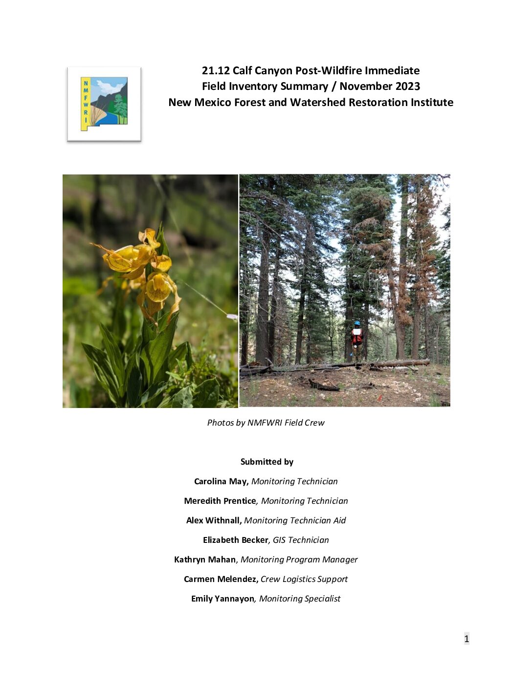
During June 2014, June 2019, and June 2023, the NMFWRI inventory and monitoring crews measured 9 plots across approximately 89 acres in the Calf Canyon region of the Gallinas watershed in the Pecos-Las Vegas Ranger District of the Santa Fe National Forest. These plots were established to monitor the CFRP project 21.12 entitled “Gallinas Watershed Implementation Project” hereafter referred to as “Calf Canyon CFRP.”
In spring 2022, this project area burned in the Hermit’s Peak Calf Canyon (HPCC) wildfire at low to moderate composite burn severity.
21.12_CalfCanyonCFRP_PostFireImmediate_USFS_2023_UPL_PFIRE

During August 2008 and September 2022, NMFWRI inventory and monitoring crew measured 6 plots across approximately 25 acres in Mineral Hill area of the Tecolote Creek Watershed. The site is predominantly ponderosa pine but includes oak species and is at 7200 ft elevation
with gentle slopes averaging 10%.
In spring 2022, all plots were burned in the Hermit’s Peak Calf Canyon (HPCC) wildfire at low to
moderate composite burn severity.
Camp Blue Haven: Post-Wildfire Immediate Field Inventory Summary

During June 2011 and July 2023, NMFWRI inventory and monitoring crews measured 10 plots across
approximately 98 acres in the Encinoso Canyon region of the Tecolote Creek watershed in the Pecos-Las
Vegas Ranger District of the Santa Fe National Forest. These plots were established within three
Northridge units of the “Road 18 Habitat Improvement/Timber Sale” project.
All units burned in the 2022 Hermit’s Peak/Calf Canyon Fire.
Tecolote Northridge Post-fire Field Inventory Report
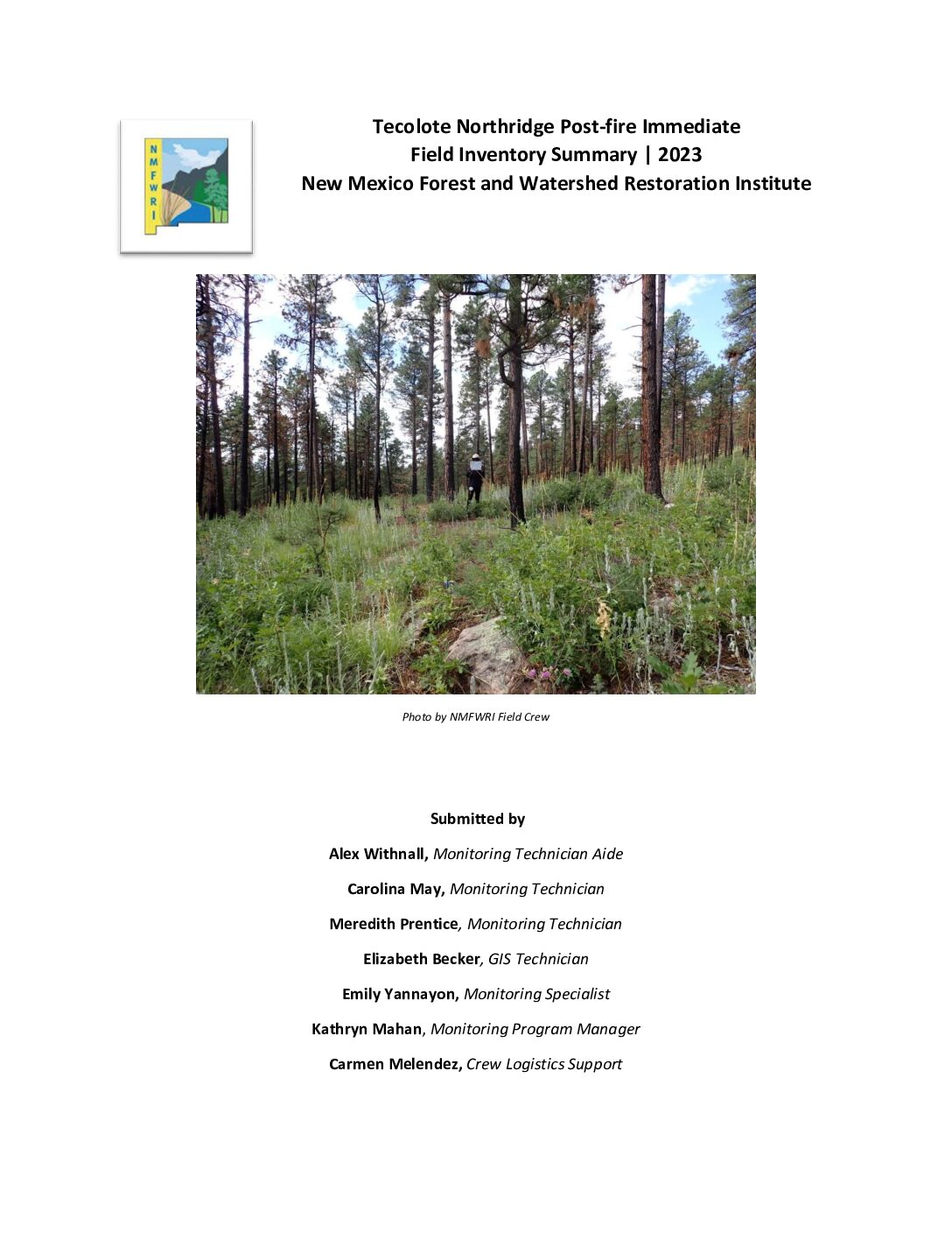
Northridge Tecolote CFRP Post-Fire Immediate Report, USFS 2023, UPL PFIRE. During June 201 1 and July 2023, NMFWRI inventory and monitoring crew s measured 10 plots across approximately 98 acres in the Encinoso Canyon region of the Tecolote Creek watershed in the Pecos -Las Vegas Ranger District of the Santa Fe National Forest. These plots were established within three Northridge units of the “Road 18 Habitat Improvement/Timber Sale” project. The project area was thinned following 2011 pre – treatment data collection , but NMFWRI does not have further details on the treatment. In spring 2022, all units were burned in the Hermit ’s Peak Calf Canyon (HPCC) wildfire at low to high composite burn severity.