News
Bark Beetle Management workshop a hit
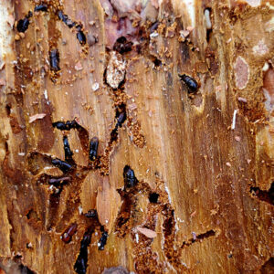
As part of our continuing Querencia in Action series, NMFWRI hosted a bark beetle workshop in Rociada with instructor Victor Lucero, Forest Health Coordinator for
As part of our continuing Querencia in Action series, NMFWRI hosted a bark beetle workshop in Rociada with instructor Victor Lucero, Forest Health Coordinator for

NMFWRI’s Ecological Monitoring team spent a December day in the field at Rowe Mesa with staff from USGS, coring trees on treated and untreated sites
The New Mexico Forest and Watershed Restoration Institute (NMFWRI), in partnership with New Mexico Highlands University’s (NMHU) Department of Forestry and FORT-CREST, co-hosted a compelling
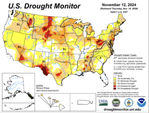
By Alan Barton,NMFWRI Director In November, newspapers had front-page articles describing a national drought, affecting 48 states. This has hit the usually humid eastern states
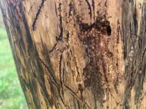
Free workshop Dec. 13 in Rociada, NM. Learn how to recognize the signs of bark beetle infestations and manage them, from Victor Lucero, NM Forestry
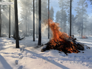
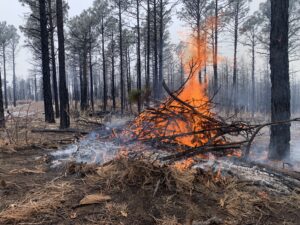
Director’s Note By Dr. Alan W. Barton Among the tools available to forest managers to reduce the risk of large, destructive wildfires, prescribed burns

Research institutes in Arizona, Colorado, and New Mexico are reshaping wildfire and fuel reduction information with a new nationwide, open-access geodatabase that will change the
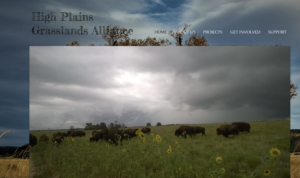
NMFWRI’s Collaboration Program worked with the High Plains Grasslands Alliance (HPGA) and the Conservation Science Center to host a September workshop aimed at providing resources
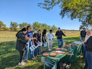
Students from 12 Northern New Mexico schools learn skills and meet professionals in natural resource management. Growing the next generation of natural resource leaders and