NMFWRI’s GIS Team has developed the New Mexico Fire Viewer, an interactive web map that provides access to real-time and historical wildfire data. The web map integrates satellite imagery and GIS layers, allowing users to search for active wildfires by name and view perimeter boundaries and hot spots. These updates, sourced from satellite infrared images, refresh every few hours. Originally launched to track the Hermit’s Peak and Calf Canyon Fires near Las Vegas, NM, the Fire Viewer now includes wildfire data statewide, covering current, recent, and historical fires.
To view the NM Fire Viewer visit: https://nmfireviewer.org/
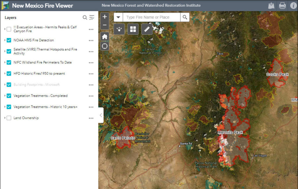
Data Layers and Features
The Fire Viewer includes multiple GIS layers to enhance situational awareness:
- Smoke forecasts
- Land ownership data
- Soil burn severity maps
- Burn scars from past fires
- Building footprints (houses, barns, and other structures, sourced from Microsoft)
- Vegetation treatment data from NMFWRI
How It Works
Built on the ArcGIS Online platform and hosted by New Mexico Highlands University, the Fire Viewer offers users a customizable experience:
- Toggle data layers on or off
- Zoom in for detailed views or out for a broader perspective
- View hot spot updates from NOAA satellites, refreshed automatically every 4 to 8 hours
- Access fire perimeter updates, provided daily by the National Interagency Fire Center
- Refresh the browser to see the latest information
Since its launch, the Fire Viewer has been accessed by over 500,000 users, making it a crucial tool for fire monitoring and response.
Collaborative Data Sources
The Fire Viewer displays information from the New Mexico Vegetation Treatment Geodatabase (vegetationtreatments.org) which compiles fuel treatment information from multiple agencies, creating a comprehensive, single-source platform for analysis. Contributors include:
- New Mexico State Forestry Division
- Bureau of Land Management (BLM)
- USDA-Forest Service
- New Mexico State Land Office
- Other federal, state, and local agencies
By bringing together these diverse datasets, the New Mexico Fire Viewer enables users to better support decision-making during wildfire events. The NM Fire Viewer will continue to be available to track future fires in New Mexico.
The NM Fire Viewer is available at: https://nmfireviewer.org.
The NM Vegetation Treatment Mapping project can also be viewed at https://www.vegetationtreatments.org/