• Skip to primary navigation
  • Skip to main content
  • Skip to footer
NMFWRI Logo

New Mexico Forest and Watershed Restoration Institute

  • About
    • Staff Directory
    • Annual Reports
    • Newsletters
    • Join Our Team
  • Restoration
    • New Mexico Plant Guides
    • Collaborative Forest Restoration Program (CFRP)
      • CFRP Long Term Monitoring
    • Desired Conditions Past Workshops
      • Gila Mountains – Desired Conditions Workshop
      • Sacramento Mountains Desired Conditions Workshops
    • Forest Visualization
    • Tamarisk Leaf Beetle
    • Restoration Resources
  • Collaboration
    • The Collaborative Conservation Mapping Project
    • Greater Rio Grande Watershed Alliance
      • NMFWRI Monitoring Work and Reports for GRGWA by SWCD
      • GRGWA Projects Online Web Map
      • Other Documents and Resources
    • Estancia Basin Monitoring
      • South Mountain Weather Station
    • New Mexico Collaborations
      • Connecting for Conservation in Santa Fe
      • Grant County Eco-Watershed Working Group
      • Magdalena Collaborative
        • Magdalena Collaborative Web Map
      • Mountainair Collaborative
        • Mountainair Collaborative Web Map
      • North Sacramento Mountains Working Group
        • Watershed Planning Map
      • Otero Working Group
        • Watershed Planning Map
      • Smokey Bear Collaborative
  • Mapping
    • NM Vegetation Treatment Mapping
    • NM Fire Viewer
    • Hermit’s Peak Calf Canyon Fire Resources
    • Field Monitoring Projects Web Map
    • GRGWA Projects Online Web Map
    • GIS Tutorials
    • Hard Copy Maps / Posters
  • Monitoring
    • Ecological Monitoring
    • UAS/Drone Monitoring
    • Research
    • Summer Student Internships
  • Stewardship
    • Education and Outreach
    • Conservation Science Center
    • Wildfire Resiliency
      • Querencia in Action: Post-Fire Land Restoration
      • Public Meetings, Events & Fairs

Contact Us

  • LinkedIn
  • Facebook

Tracking and tackling floods after fires

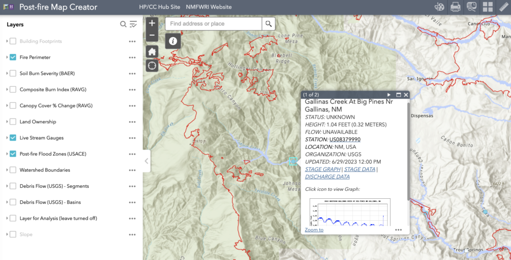
An interactive public map showing USGS stream gauges and post-fire flood zones can help people track potential risks from floods this summer in the communities impacted by the historic 2022 Hermit’s Peak/Calf Canyon Fire. The Post-Fire Map Creator was one of several online maps built by the GIS team at the New Mexico Forest and Watershed Restoration Institute during and after the HPCC Fire. The maps and more information are available on the Hermit’s Peak/Calf Canyon Resources Hub.

People can also sign up for weather alerts from the National Weather Service in Albuquerque, which will send a daily weather outlook email and flash flood watch texts. For more information and to sign up, email Scott Overpeck at scott.overpeck@noaa.gov. 

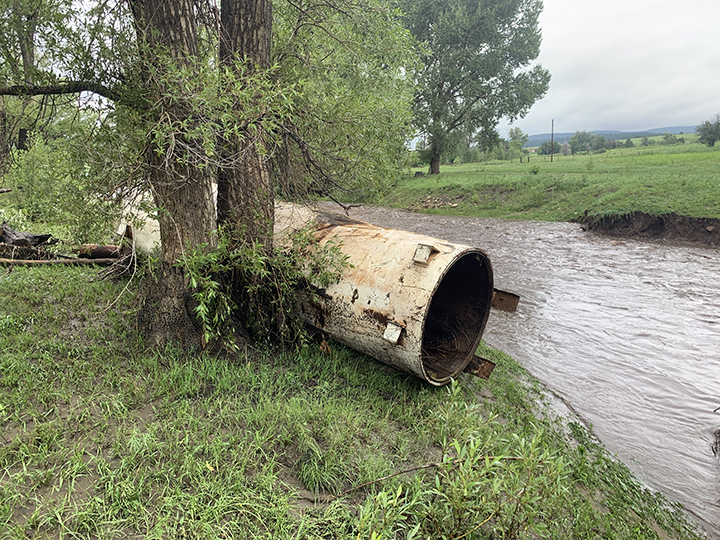
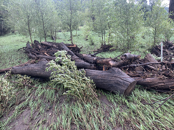
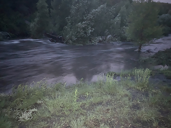
It has been a year since a heavy rain season and floods washed down tons of burned logs, buried pastures in sediment, destroyed bridges and fences, and damaged wells after the HPCC Fire.

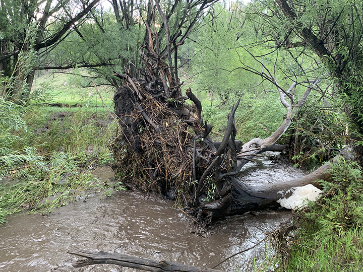
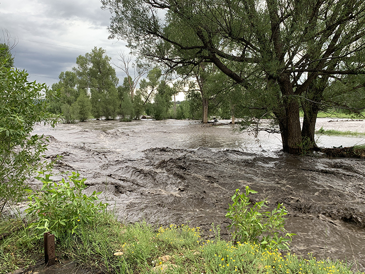
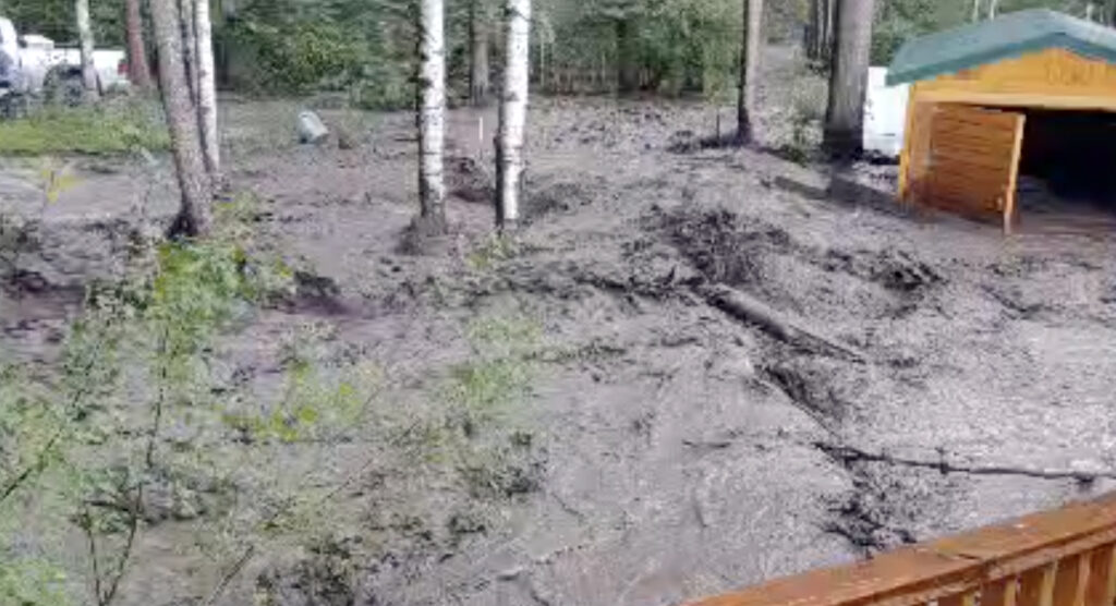
Flood damage risks after wildfires can continue for several years. State and county officials around the HPCC burn scar have been working in 2023 to help residents prepare for and mitigate flood risks. The State Fire Marshal’s office and the New Mexico Department of Homeland Security and Emergency Management worked with San Miguel and Mora county officials to deliver 10,000 sandbags by early June, according to state officials. Residents are able to use the sandbags around their homes and properties to reduce potential flood damage. The New Mexico Department of Transportation continues to work with acequia associations to dig out irrigation ditches filled with sediment. The Natural Resources Conservation Service has expanded a program to mulch and seed across burned properties greater than five acres and has a new program to offer land restoration assessment plans, with cost estimates that are recognized by the HPCC Claims Office.

In addition, volunteer organizations are continuing to help residents remove debris, build fences, plant trees, and work on erosion control measures. The need is big across the HPCC burn scar. And the needs have expanded beyond the HPCC fire as new wildfires impact the area. In May, Las Tusas Fire burned almost 1,000 acres within the HPCC burn scar near Sapello and destroyed several homes.

Video of Manuelitas Creek Flood in Sapello, June 2023.

Category icongis-projects,  news Tag iconFire,  flood,  GIS,  hpcc,  map,  nmfwri

Footer

Contact

New Mexico Highlands University
Box 9000
Las Vegas, NM 87701

(505) 426-2080
stacimatlock@nmhu.edu

Connect

Facebook
LinkedIn

Partners

Highlands University
Colorado Forest Restoration Institute
Ecological Restoration Institute
After Wildfire
All About Watersheds
New Mexico State Forestry
USFS Region 3

The New Mexico Forest and Watershed Restoration Institute at New Mexico Highlands University receives financial support through the Cooperative and International Programs of the U.S. Forest Service, Department of Agriculture, under the Southwest Forest Health and Wildfire Prevention Act. In accordance with Federal law and U.S. Department of Agriculture policy, this institution is prohibited from discriminating on the basis of race, color, national origin, sex, age, or disability. (Not all prohibited bases apply to all programs.) To file a complaint of discrimination, write to USDA, Director, Office of Civil Rights, 1400 Independence Avenue, SW, Washington, DC 20250-9410 or call (800) 795-3271 (voice) or (202) 720-6382 (TTY). NMHU is an equal opportunity provider and employer.