Mapping
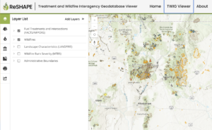
ReSHAPE
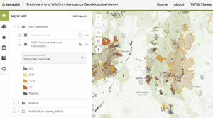
The Southwest Ecological Restoration Institutes ReSHAPE Program Compiling and displaying existing information on fuel treatment projects and wildfires at the national level. Coordinating and facilitating
The Southwest Ecological Restoration Institutes ReSHAPE Program Compiling and displaying existing information on fuel treatment projects and wildfires at the national level. Coordinating and facilitating
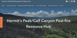
The Hermit’s Peak/Calf Canyon (HPCC) Post-Fire Resource Hub shares critical and timely data with the public and impacted communities, and hosts restricted maps and data
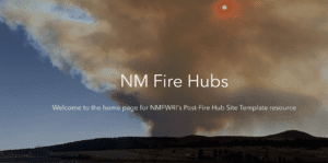
NMFWRI has built a NM Fire Hub template that is quick to set up and share critical fire and post-fire information with impacted communities and

Research institutes in Arizona, Colorado, and New Mexico are reshaping wildfire and fuel reduction information with a new nationwide, open-access geodatabase that will change the
By Dr. Alan Barton, DirectorNMFWRI In the 21st century, collaboration has played an increasingly important role in coordinating resource management across large landscapes. One of
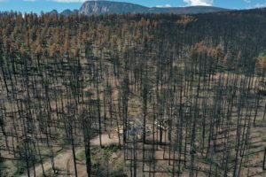
The largest wildfire in New Mexico’s recorded history will have lasting impacts on our community and our watershed. NMFWRI has helped to create web based
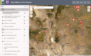
NMFWRI’s GIS Team has developed the New Mexico Fire Viewer, an interactive web map that provides access to real-time and historical wildfire data. The web
The following video is a recording of a webinar held on March 31, 2021. Watch the video to learn how to use the data available
January – March 2021 Maps are a proven way to bring partners around the table and identify areas and issues of common concern. Everything happens